Soomaa's fifth season, when rivers spill into the forest
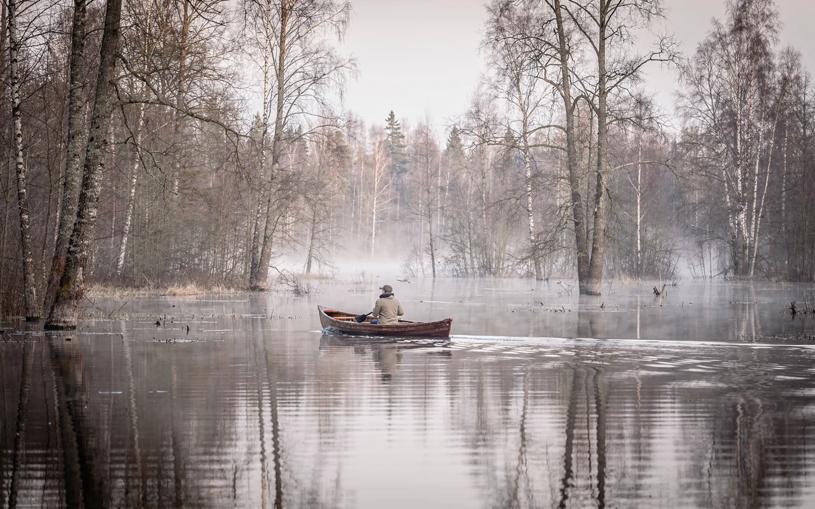
Every spring, melting snow transforms Soomaa National Park into a vast inland sea, creating a temporary aquatic landscape where travelers navigate flooded forests by canoe.
A landscape shaped by water
Soomaa National Park, established in 1993 in south-west Estonia, is known across the region for its dramatic seasonal transformation. While the northern European calendar typically recognizes four distinct periods, local residents and naturalists have long counted an additional phase known as the fifth season. This transitional window arrives when winter snows melt rapidly and spring precipitation swells the surrounding river systems beyond their banks. Instead of draining away immediately, the excess water pours across open fields, woodlands, and country lanes, temporarily submerging vast tracts of the park.
During this high-water period, the landscape takes on the appearance of an expansive inland sea broken only by stands of submerged trees and isolated patches of higher ground. Water levels can rise by several meters in a matter of days, completely redrawing the local geography and altering daily movement. Footpaths and rural roads vanish beneath the surface, making motorized transit impossible in affected areas. For those living nearby and visiting, the flood is not viewed as an emergency, but rather as an anticipated natural rhythm that defines the character of the reserve.
Raised bogs and expanding rivers
The physical geography of Soomaa explains why these extensive inundations occur year after year. The national park protects an expansive network of raised bogs, which act like massive peat sponges resting higher than the adjacent river valleys. Several winding rivers converge in this lowland basin, including the Navesti, Halliste, and Raudna rivers, creating a natural drainage bottleneck during sudden thaws. Because the ground remains partially frozen beneath the surface, water cannot easily infiltrate the soil, leaving it nowhere to run except across the floodplains.
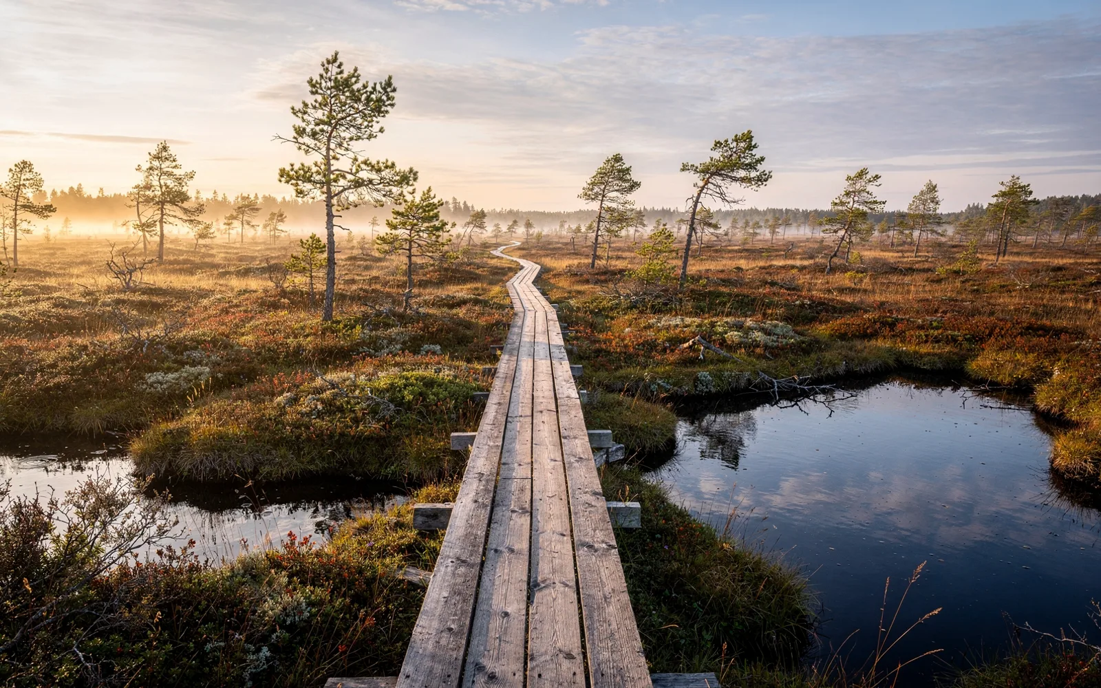
As the swollen channels spill into alluvial meadows and ancient forests, they create vast temporary waterways that stretch for miles. The raised bogs themselves often remain dry islands within the flood, elevated above the surrounding deluge. These massive peat formations have developed over thousands of years, absorbing immense quantities of water and regulating moisture across the park. The interplay between the elevated bogs and the flooded lowlands creates a patchwork of contrasting environments, where aquatic channels run directly alongside spongy peat moss plains.
Canoes and ancient dugout traditions
When the fifth season arrives, traditional modes of overland transport give way to small watercraft. Modern canoes and kayaks offer visitors a unique way to glide through flooded groves, passing right between tree trunks that normally stand dry on woodland soil. Paddlers can travel directly over submerged country roads, farm pastures, and lower walking trails, observing the forest from an elevated perspective that only high water allows. The stillness of the flooded woods creates an unusual atmosphere, where the sound of dripping paddles replaces the crunch of footsteps.
This reliance on water transportation is rooted in centuries of regional history. For generations, local inhabitants carved single-log dugout boats, known as the haabjas, using the trunks of large aspen trees. These lightweight craft were specifically suited for navigating shallow, flooded woodlands and connecting isolated homesteads when ordinary routes were submerged. Today, the craft of making and paddling the haabjas remains an integral part of Soomaa's cultural heritage, preserving traditional knowledge alongside modern recreational canoeing.
Wildlife adaptations and boardwalk trails
The sudden rising of the rivers presents both challenges and opportunities for the wildlife that inhabits the national park. Mammals such as elk must retreat to higher ground, gathering on forest ridges and unflooded peat expanses until the waters recede. Beavers, on the other hand, thrive in this aquatic environment, using the high water to reach feeding areas and transport branches with minimal effort. Bird species also gather around the flooded meadows, taking advantage of the rich feeding grounds that appear as the waters stir up nutrients across the basin.
Even when floodwaters are high, visitors can experience the national park safely on foot using maintained infrastructure. Elevated wooden paths, such as the Riisa bog trail, allow walkers to venture deep into the landscape without disturbing the sensitive ecosystem. These boardwalks weave across raised bog plains, leading past peat pools, dwarf pines, and open heather landscapes that remain accessible regardless of river levels. Once the fifth season passes and the rivers retreat into their beds, the meadows dry out, revealing renewed soil ready for the northern summer.
Spotted an error? Write to newsroom@nordexanews.com. Corrections are noted at the end of the article. See our editorial standards.