Tartu's old observatory and a chain of survey points across Europe
A historic hilltop observatory in Estonia served as the starting baseline for a nineteenth-century survey that mapped the curvature of the planet across thousands of kilometers.
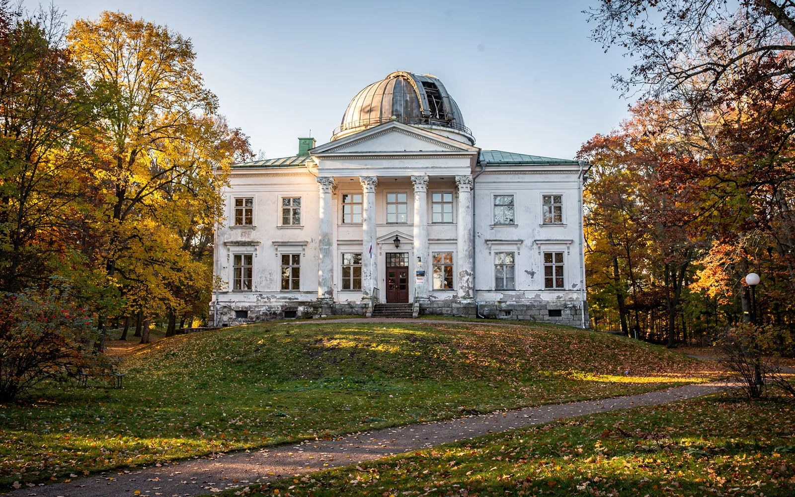
A hilltop landmark for astronomy
On Toome Hill in the university town of Tartu stands a neoclassical building with an enduring connection to earth science. The Tartu Old Observatory was constructed in the early nineteenth century to provide a modern center for astronomical research. Its elevated position above the town gave scholars a clear view of the night sky, away from dust and ground obstructions.
From its earliest years, the building housed advanced optical equipment and precision clocks designed for exact positional measurements. Scientists working at the site tracked stellar movements, calculated planetary positions, and gathered baseline data about the local latitude and longitude. The hilltop quickly grew into an internationally respected center of calculation, observation, and cartographic inquiry.
Mapping the shape of the globe
The German-born astronomer Friedrich Georg Wilhelm Struve served as the director of the Tartu observatory and guided its most ambitious scientific project. Between 1816 and 1855, Struve coordinated an expansive geodetic survey designed to determine the precise size and shape of the Earth. Scientists knew that the planet was not a perfect sphere, but exact figures required rigorous mathematical measurement across vast distances on land.
To achieve this goal, Struve made use of triangulation, a method that links visible landscape points through a network of connected triangles. Surveyors erected signals on hilltops, church towers, and specially constructed wooden towers, measuring angles with specialized theodolites. By measuring a single baseline distance on the ground with extraordinary care, the survey team could mathematically calculate the lengths of all subsequent triangle sides across hundreds of kilometers.
A chain from Norway to the Black Sea
The resulting survey network became known as the Struve Geodetic Arc, forming a long meridian chain across the continent. The chain begins in Hammerfest, Norway, on the shores of the Arctic Ocean, and extends southward all the way to the Black Sea. The Tartu Old Observatory served as the foundational station for this enormous undertaking, anchoring the calculations that spread across rolling plains, forests, and remote northern hills.
In 2005, the United Nations Educational, Scientific and Cultural Organization inscribed the Struve Geodetic Arc on the World Heritage list. The inscription specifically honors thirty-four preserved station points located across ten modern countries. These points include simple brass plaques fixed in bedrock, stone markers, and prominent observation buildings such as the observatory in Tartu. The preservation recognizes a remarkable feat of nineteenth-century international scientific collaboration that united astronomers, mathematicians, and field surveyors over four decades.
A preserved center of discovery
Today, the Tartu Old Observatory functions as an active museum dedicated to the history of science and space exploration. Visitors can walk into the restored meridian hall, view historical globes, and inspect early nineteenth-century telescopes that once guided Struve and his colleagues. The building maintains the original observation platforms and instruments, illustrating how early researchers transformed mechanical precision into lasting geographical knowledge.
The site continues to demonstrate how local scientific facilities contributed directly to global understanding. By serving as both the intellectual heart of the meridian survey and a physical station point, the observatory linked the Baltic landscape to an international standard of measurement. Its surviving instruments, stone markers, and exhibition halls offer a quiet look at the quiet precision that helped define modern cartography.
Spotted an error? Write to newsroom@nordexanews.com. Corrections are noted at the end of the article. See our editorial standards.